
 .
. 

To create a landscape add water; or not. After a trip to natural areas in West Texas I am reminded of the power and necessity of water. In the Great Lakes region, we know well (sometimes to the point of forgetting) that our defining lakes, fish-full rivers, verdant vegetation, and our economic future all depend on water. Ten days in and between Big Bend National Park and the Davis Mountains had me thinking as much about Michigan as it did Texas. Attending to the water realities in both places–all places really–must move from afterthought to a leading priority.
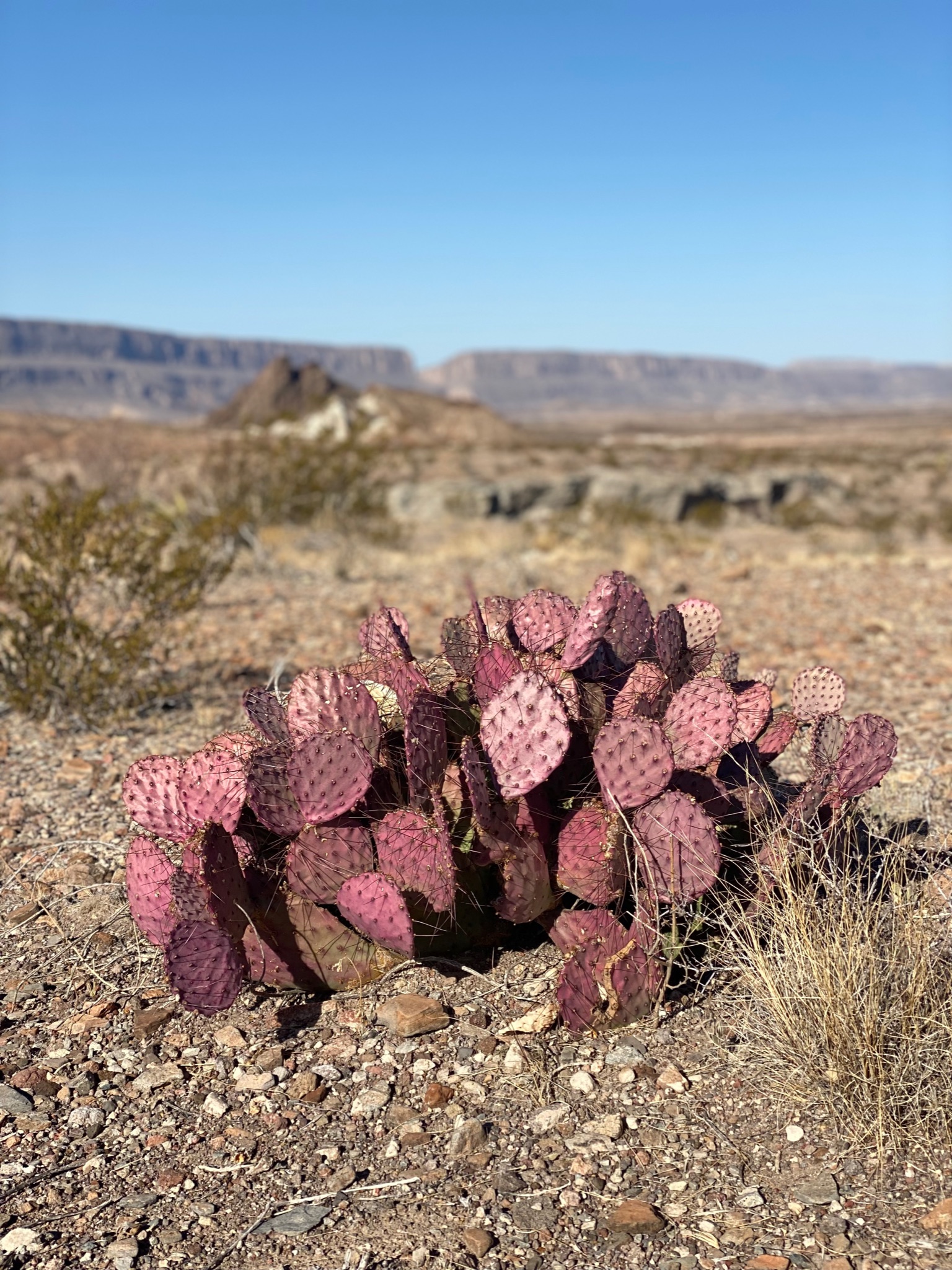
Hiking had me first think of water. In the wide open spaces of West Texas–so different than the tree enclosed places of my home state–the dry landscape ironically shows the power of water. As I hike among creosote bushes and prickly pear cactus on the plain around the Chisos Mountains, the flat desert trail gives way to a slide down a gravel bank and a shoe-filling walk in the sand of a dry streambed. Three switchbacks up another wall of small stones as smooth as any Lake Huron beach and I look back and then left and right to see a dry river cutting across the landscape, The water was here once, in much more volume than occupies this stream course today.
The surface geomorphology in West Texas tells a story of water. Limestone formed in ancient seas sit atop mountain peaks; flat slate and other water deposited stones are tipped crazily and scattered across the dry landscape, Uplifts, sharp faults, prehistoric volcanic cores and other geologic markers are on display, not hidden by trees and bushes, covered by glacial deposits, or under a freshwater lake. Trying to make sense of the earth history leaves me appreciative of the basin of rock layers underlying Michigan and the central Great Lakes, a geology which has been described as a bowl filled with gravel and water.
The hike towards the Chisos continues across an upslope and then descends into an enormous dry river valley 100 feet deep and three times as wide. I think of the Niagara River without water, or the now gentle Maple River valley near my home that once carried a giant river draining off the melting glacier atop Saginaw Bay. In late February in West Texas spring seems imminent as the sun stands alone in blue skies and the temperature passes 70. How perverse to learn that spring is a dry season here. Most of the rain falls in summer, when monsoons sweep across the desert randomly distributing flash floods.
The mountains of West Texas–Chisos, Davis, and Guadalupe–stand as islands in the desert and attract what little moisture falls; thus they support more, and different, life. The scraggly pinon pines at higher elevations make me think of the jack pines of the Au Sable Plain. But there is no trout stream at the bottom of a sandy slope. Rather, several of our hikes took us into rocky canyons cut deep by thousands of years of flows from wetter climates eons gone by and kept clear of vegetation by summer floods. These explorations added a new term to my geographic lexicon: pour-off. It’s a hollowed out drop, a dry waterfall, where flowing water has smoothed the rock at a narrow part of a canyon. More than once, our hike was stopped at a pour-off. We were left to ponder, “Where is the water?”
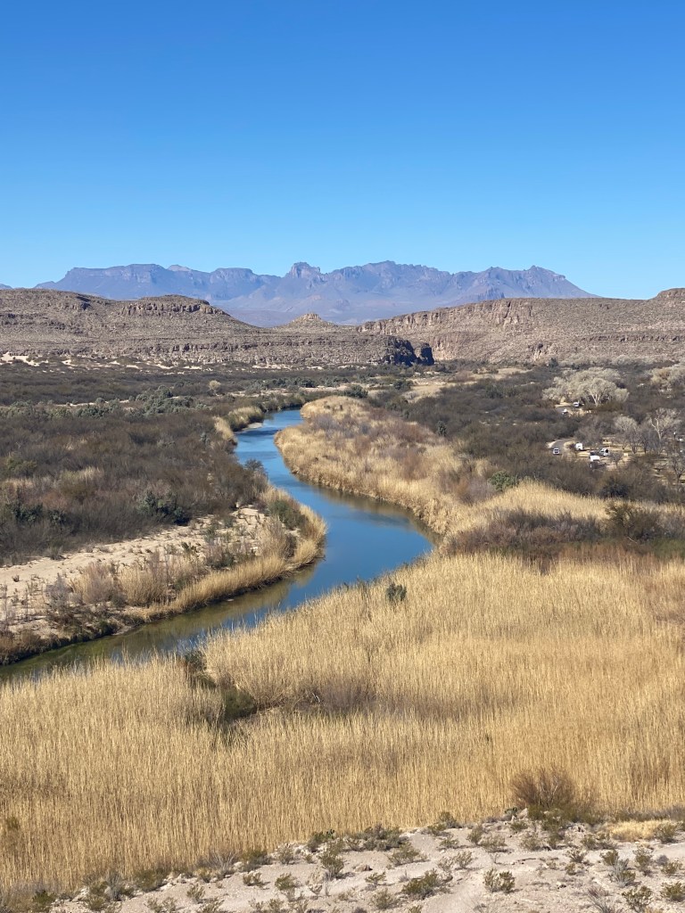
I love rivers, and the Great Lakes region has so many to enjoy and appreciate. By its scarcity of water, a trip to the Lone Star State must consider the Rio Grande, the fifth longest river on the continent and the international boundary for 1,200 miles along the southern edge of Texas. Because of the political charge given to border issues, I was not sure what to expect, but I was surprised that such a celebrated and notorious river seems so insignificant in its flow. But again, the landscape belied its tame manner: dry side channels, erosion remnants high on the banks, and canyons cut deep into hard rock all indicate the sometime power of the Rio Bravo, as many Mexicans call the river..
The reading of a few interpretive signs from the National Park Service, or a quick internet search, provides the rest of the story: the Rio Grande now flows at less than 20 percent of what it did in just the last century, and in some dry years no water at all has reached the Gulf of Mexico. Upstream diversions for mostly agricultural use have greatly diminished the flow. Climate-induced drought and several growing cities on both sides of the border exacerbate demands for Rio Grande water. Thankfully, the Rio Conchos, which drains Mexican Chihuahua, keeps the Rio Grande as a source of life for plants, trees, and other riparian life in Big Bend. Not surprisingly, the best birding of my trip was along or near the Rio Grande.
Water knows no national borders in its uninterrupted state, and life passes over, through, and with the Rio Grande River. In fact, the initial ideas for a national park in Big Bend were for an international park shared between Mexico and the United States (learn more of this history from the National Park Service). Although efforts continue to coordinate conservation efforts in the region, the over-allocation of the Rio Grande constrains this work. More informed, my walks along the Rio Grande had me appreciate the good fortune of the Great Lakes to have abundant water, laws that consider the environment in water allocations, and the commitment of the International Joint Commission to water quality in the shared waters of the United States and Canada.
“Water is the ultimate res publica–a public good–a moving, formless substance that defies private ownership, is hard to contain, and requires collective management” argues Giulio Boccaletti in his new book “Water: A Biography.” Human civilization has been largely shaped by the necessity of having a controlled supply of water. We see this in dams and large-scale irrigation projects, the infrastructure of pipes underneath our cities, and here in the desert where human settlement has been curtailed by the lack of water. Our best campground, Cottonwood, was located in the remnant of a former agricultural community, and we could hike to the abandoned homes of entrepreneurs, the stone walls and fireplace the only reminder of dreams cut short by the lack of water and punishing heat.
The presence of water, however, is not enough to ensure prosperity. On a warming planet, where climate factors are redistributing water sources and flows, places with an abundant supply of water may be in a better position to support future growth and development. But the complexities surrounding the supply, demand, and, increasingly, the quality of water vex water managers and governmental bodies, even in the Great Lakes region. We look at these “five enormous lakes and assume there’s more than enough water for everybody,” said David Dempsey, “but we have tons of unresolved problems.” These must be addressed if we are to equitably realize the potential of our water.
Water moves in a cycle from liquid to gas and then to precipitation, from rain to river to large body of water and back again. In the Great Lakes we know the water cycle firsthand from our lake effect rains and snows. We tend to overlook the slower cycle of water moving from rain on the surface to ground water infiltration and then to human use, even though Michigan has more people (2.5 million) who get their water from residential wells than any other state. Groundwater is mostly invisible, and in a region where water appears everywhere, we tend not to think about what we cannot see.
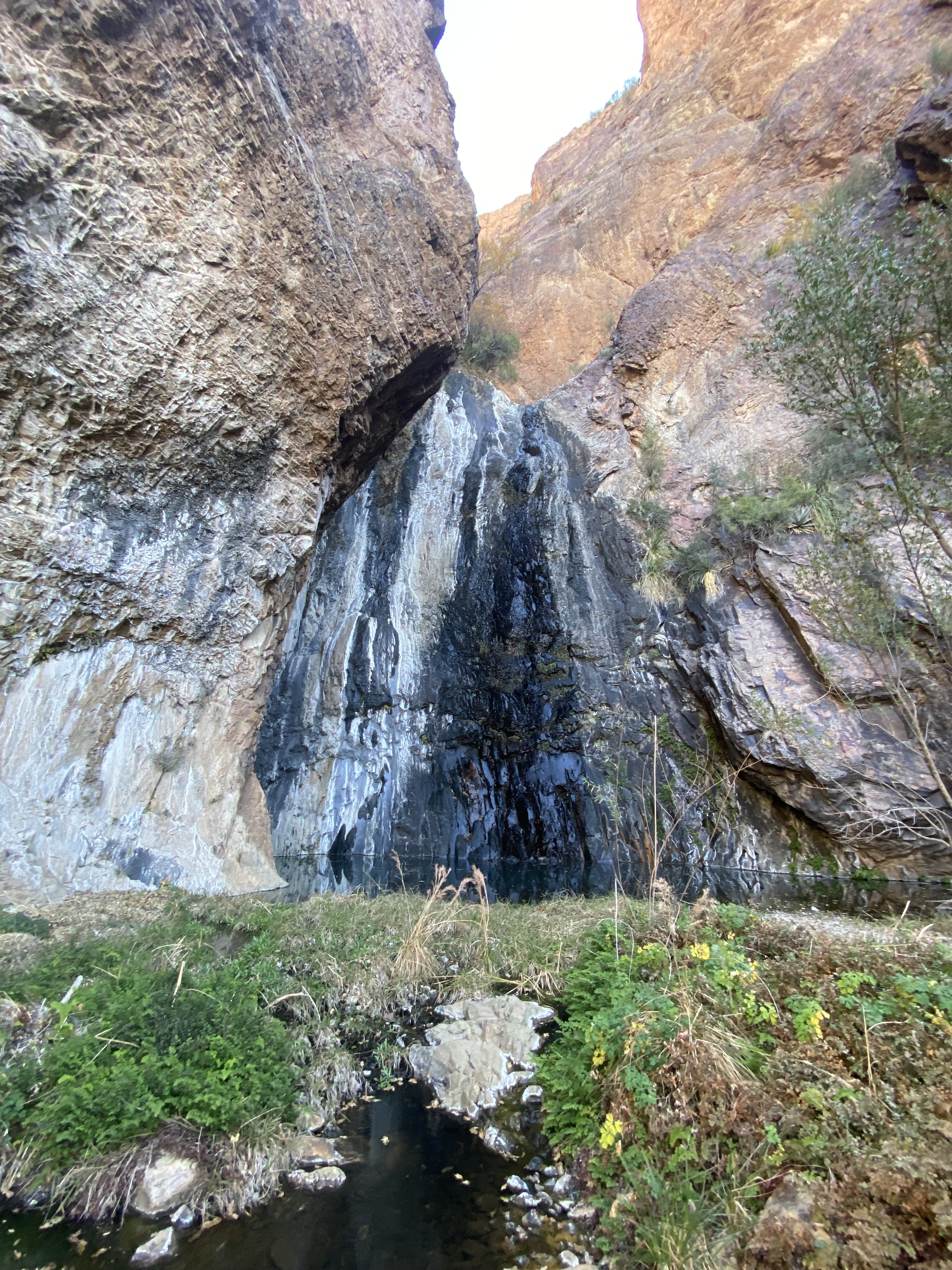
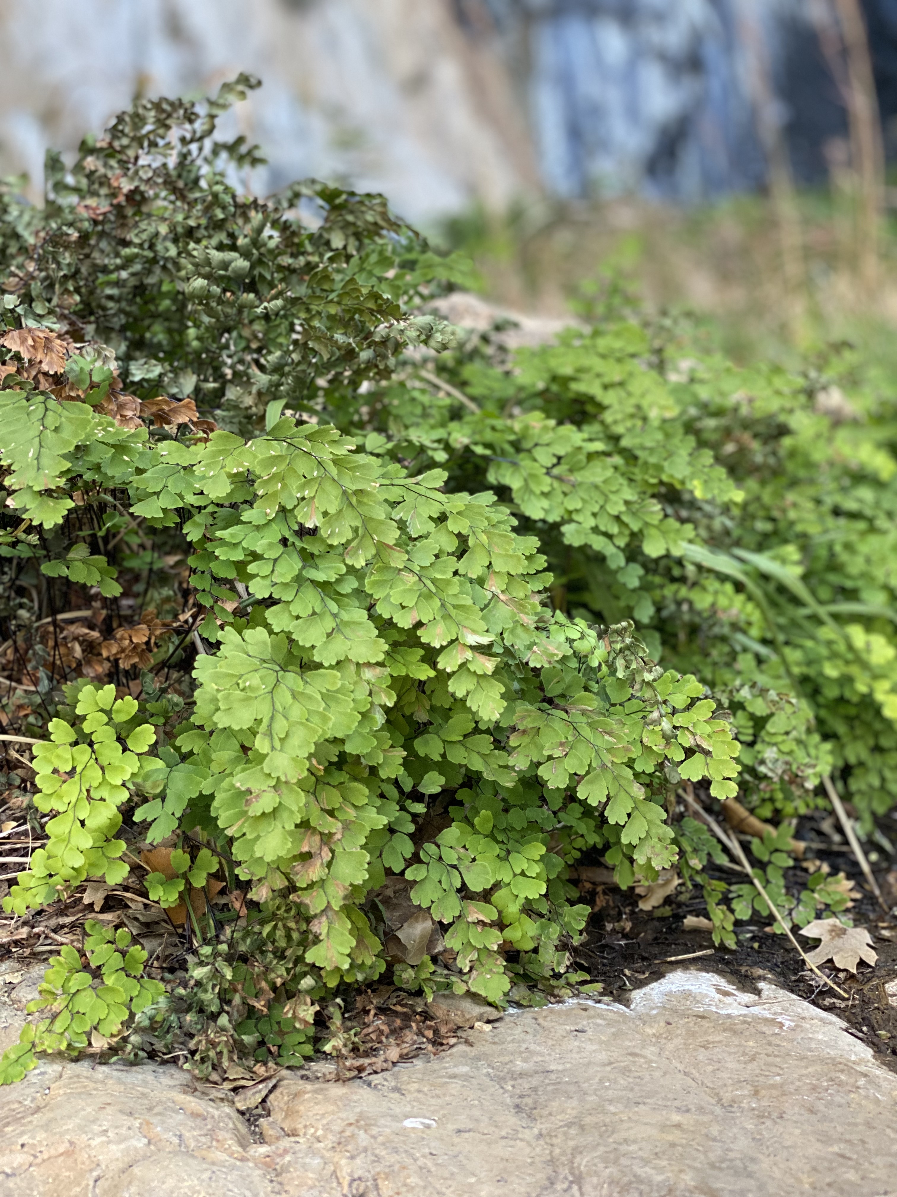
But a Michigan visitor to West Texas thinks about water because it is so clearly missing. Where did it go? Underground. Water that fell on the dry land years ago as rain or snow seeps back out of the ground when it encounters the crazy geology underlying the desert. These springs, no matter how small, are celebrated, usually marked on maps, and often the site of vain attempts at settlement. Two of our hikes led us to such places, one at the base of a weeping cliff, the other tucked into a small cleft in the open desert. After scrambling over rough rocks and through dry reeds, I catch a sound I have not heard at all in the several days of hiking nor in the months since I was outside in non-frozen nature: the chink and jingle of water over stone. How delightful to find damselflies, maidenhair fern, and even frogs after a dusty hike
. .
. 
I think of how such seeps in Michigan’s Jordan River Valley have turned parts of my favorite trail to muck. That’s the problem though: in Michigan when we think of groundwater at all, we think of it as commonplace or even an annoyance. But that is not the reality. “Given the ubiquity and visibility of surface water throughout the Great Lakes region, groundwater historically has been an understudied, underfunded, and underappreciated natural resource,” said a group of scientists and policy makers in a recent report. They are calling on us to regard our groundwater as the sixth Great Lake, worthy of as much attention as the beloved five.
The primary problem is not considering the nuance of place. Even though Michigan is surrounded on all sides, and underneath, by water, it’s not available everywhere. The subtleties and differences of underground water flow are revealed whenever we identify and try to remedy chemical contamination, PFAs being just the latest persistent pollution to contaminate our subsurface waters. In some places, groundwater is no longer readily available. There are now about 10,000 wells used for agricultural irrigation, more than twice as many then there were in 2008. The use of Michigan springs for bottled water alarms many, but we should be more concerned with our wetlands. Michigan has unique wetlands, called fens, that depend on groundwater. Also, scientists have discovered that many of our important coastal wetlands are fed from underground. Groundwater supplies 67% of the water flow in our larger rivers and tributaries. There is more to groundwater than meets the eye.
Texas may be better prepared to deal with water issues because its water sources have long been constrained. This is not to say that present and future water challenges will be easily met there (or anywhere), but Texas has an explicit State Water Plan that outlines a strategy for meeting human needs while protecting the natural systems upon which a secure water system depends. The Nature Conservancy in Texas is one of several groups leading the policy effort, while also taking specific actions to protect water sources. In the Great Lakes, we tend to think about protecting surface water, but in Texas a lot of the attention is on protecting water underground, like the Edwards Aquifer, which provides San Antonio and several other cities with their water supply. The Nature Conservancy has helped identify key recharge areas and has helped local governments create funding mechanisms to protect more than 160,000 acres of land, thus ensuring both water quality and quantity. While some efforts like this have been made in Michigan, we understand too little and act too haphazardly to protect our groundwater.
Where does your water come from? Where does your water go? These are perhaps the two most important questions we need to ask ourselves. And the answers “from the tap” and “down the drain” merit a failing grade. In the Great Lakes we too often, unwisely, take our water for granted. We need to conserve the natural systems that deliver us clean, safe water whether that be a nearby lake or river, or the underground reservoirs largely unknown to us. As well, we need to pay more attention to what happens to the water and human waste we flush down the toilet, the contamination we spill on the land, and the direction and content of stormwater and agricultural drains. We all live in a place, and the source and disposition of water in that place defines our relation to nature.
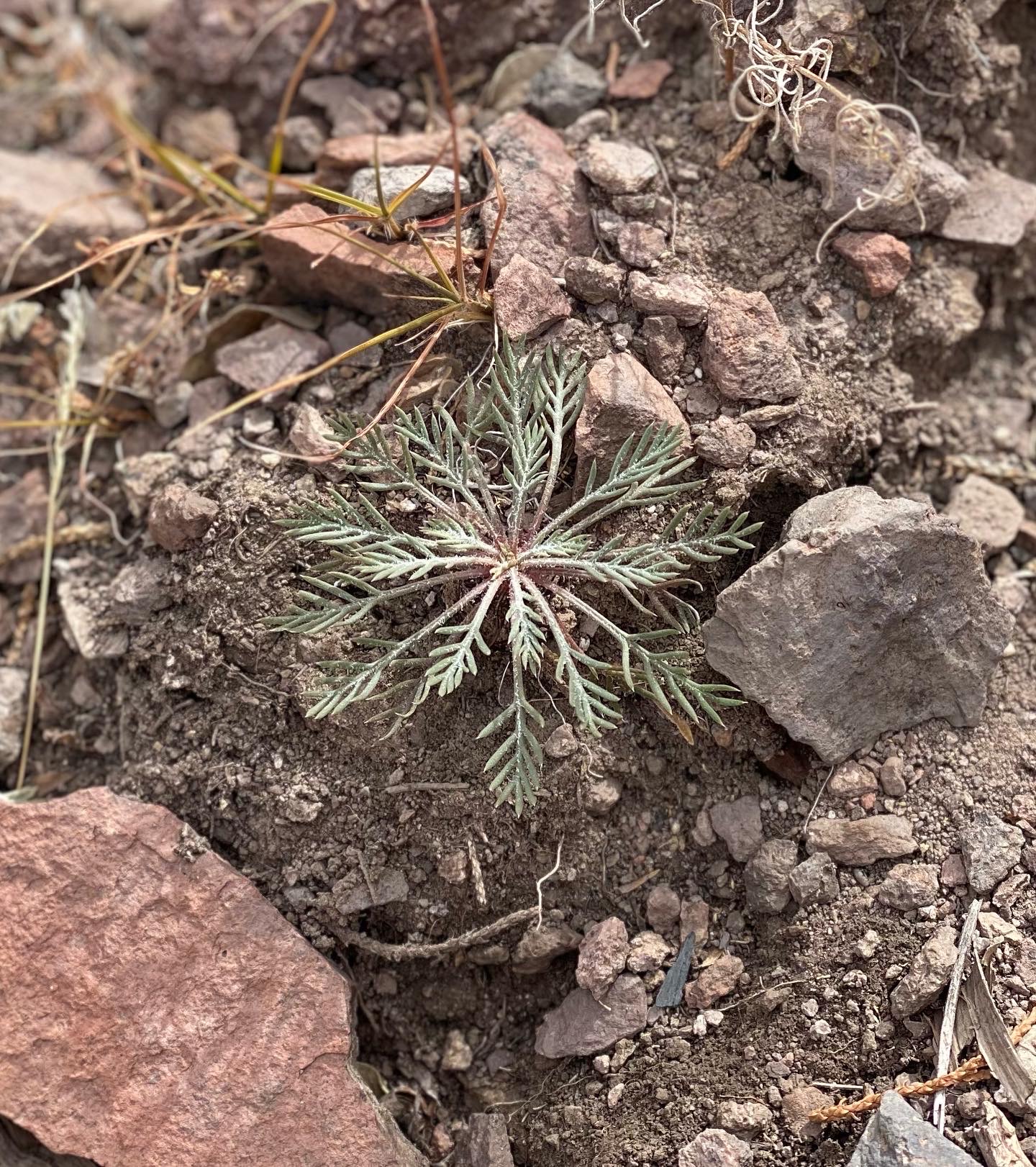
Resurrection Plants Selaginella lepidophylla are one of the special species that occupies West Texas, one that makes tangible its unique geography just as the dwarf lake iris does in northeast Michigan. Most of the time these small ground plants, related to clubmoss, are dry, curled up clumps that most observers would take for dead. They survive intense periods of drought in this state, awaiting some form of precipitation. When water does arrive, these vascular plants quickly revive, uncurl, and add green to the otherwise dull-colored ground. On a hike in the higher elevations of the Davis Mountains, we found small patches of snow in dark hollows, nearby resurrection plants along the trail surprised and delighted us
. .
. 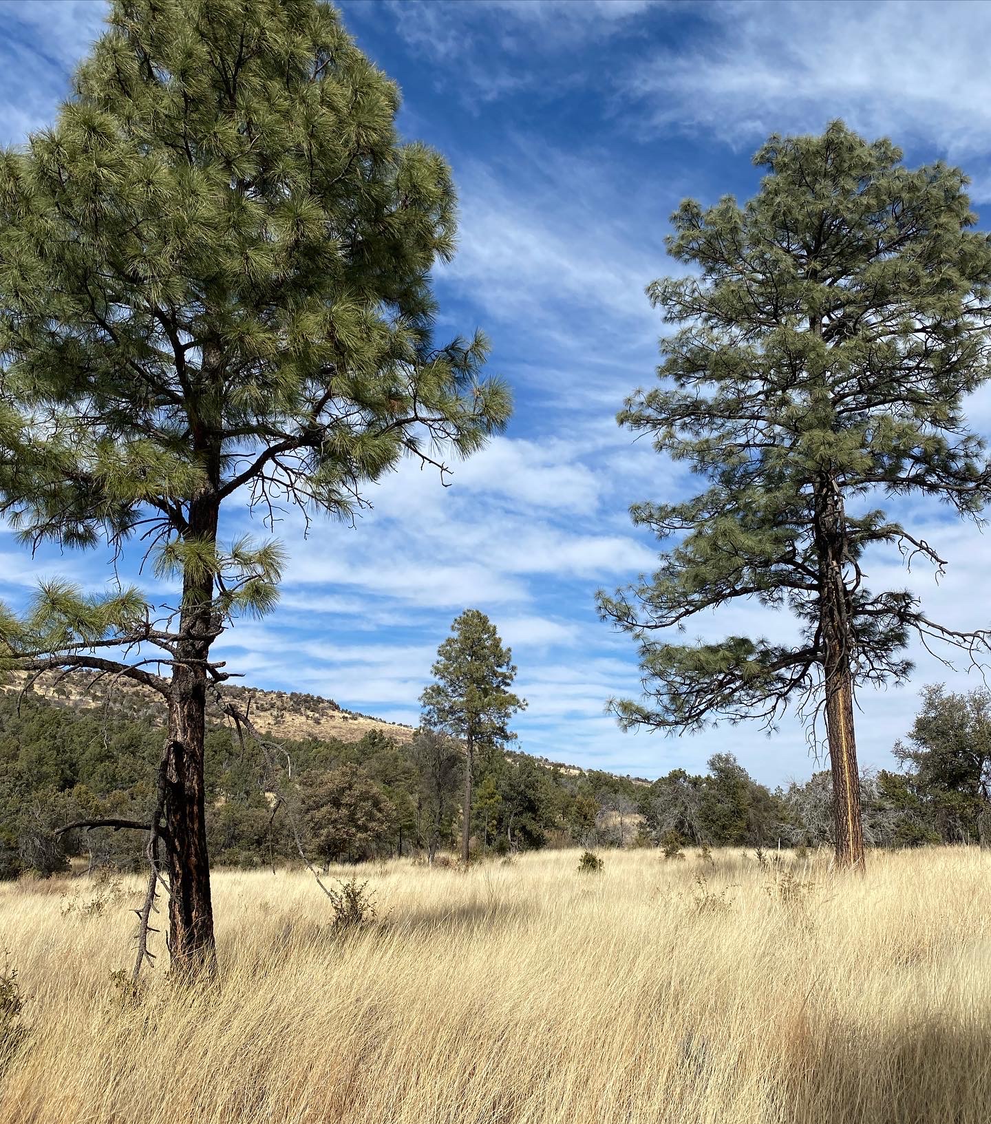
The Nature Conservancy has a 30,000 acre preserve in the Davis Mountains halfway between Guadalupe and Big Bend National Parks. The vegetation–oaks, pines, and grasses–are different than the desert, and when we visited, their brown slopes pocked with green reminded me of the California foothills, except that they weren’t green in winter. Almost as surprising were the stands of ponderosa pines, at the most southeasterly extent of their range in North America. Here water has not so clearly shaped the land, but the arrival of water determines the color and texture of the hillside vegetation.
In the Davis Mountains on the last day of our Texas sojourn it rained for the first time of our trip, and it had me thinking of water and the climate which determines its distribution over time and space. The plants and animals of this region are remnants from a time well before the appearance of humans when the climate was much cooler and wetter. Living outdoors in the desert–hiking, eating, sleeping–for days in a row inescapably drives home the value of water. The landscape shouts about the power of water, and the resurrection plant whispers the reminder of its necessity for all life.

Great prose but great pictures as well. Thanks for sharing.
Tom P
LikeLike
well said. i saw BB from a SoCal slant. you can fit a million perspectives in that park!
LikeLike